Product Brief Introduction
NavGlobe is a powerful 3d display tool for global navigation data. Its functions including graphically display global navigation data, custom data (enroute, airspace, obstacle, NOTAM etc.) and flight simulation, as well as GIS functions such as 3D-earth, digital elevation, vector image etc. NavGlobe can be used for graphic display of aviation data, terminal procedure verification, flight preparation, flight operation monitoring, NOTAM impact analysis and other scenarios.
NavGlobe trial version download
Aeronautical Data 3D Display Functions
1
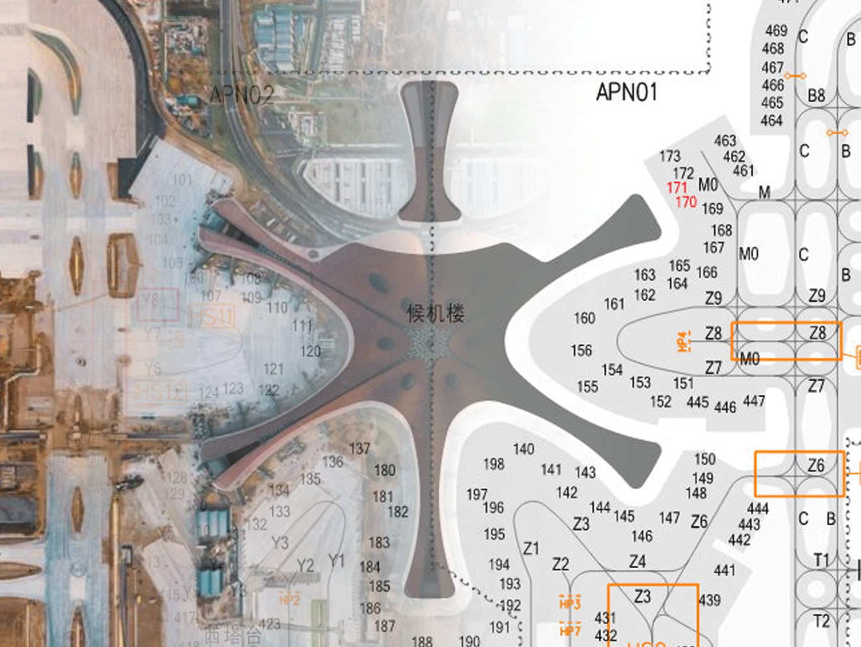
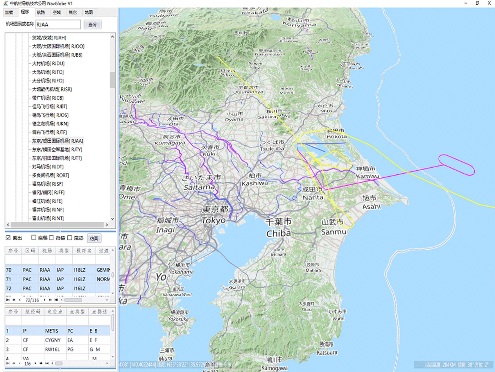
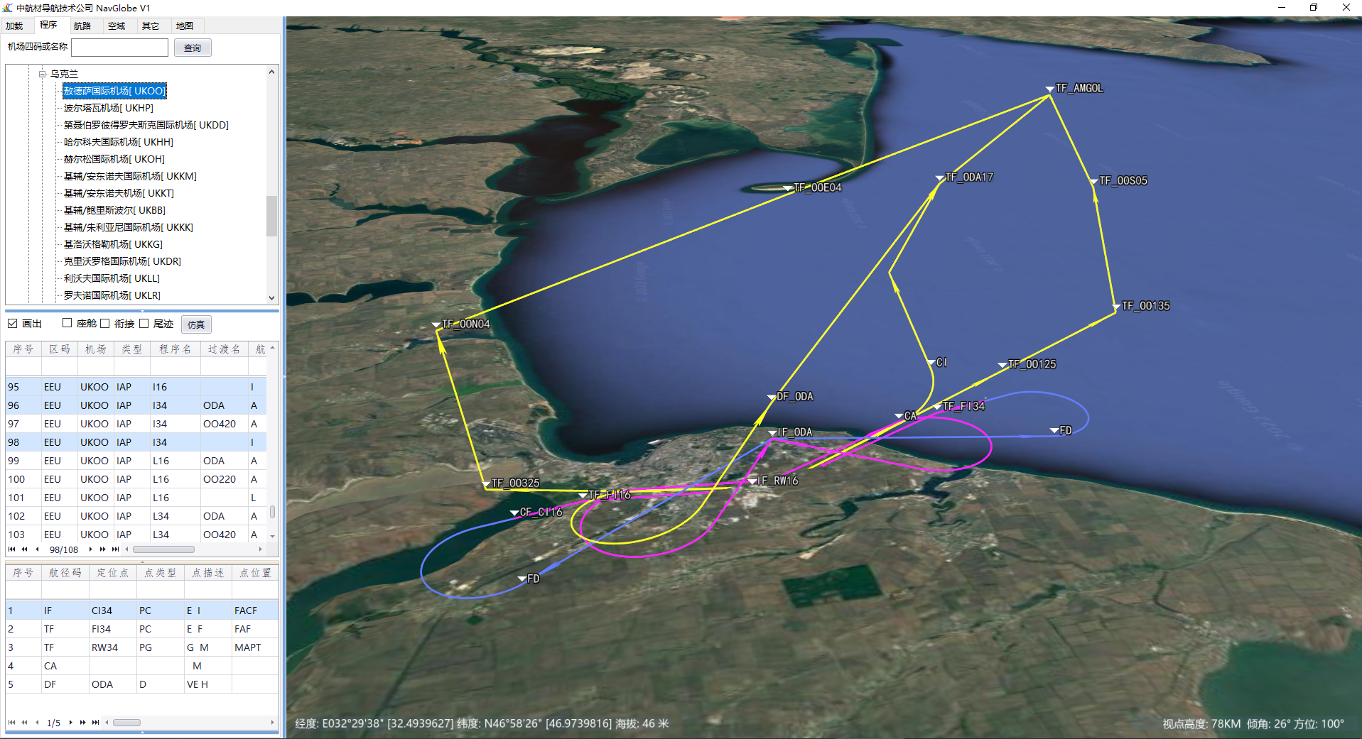
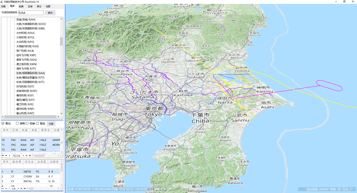
Global navigation data 3D display
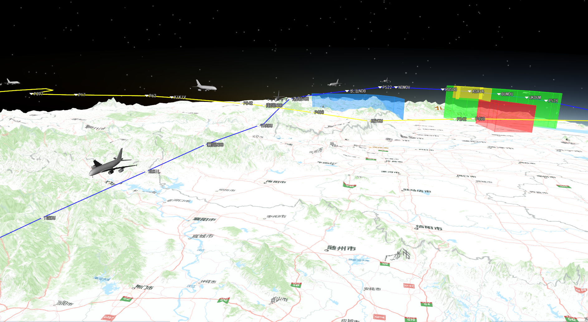
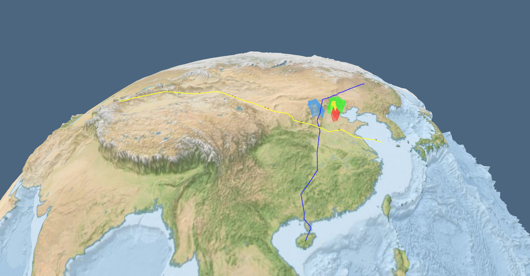
NavGlobe loads global navigation data in ARINC424 format and displays aviation elements such as airport, navigation facilities, terminal procedures, enroute and airspace in 3D manner。
2
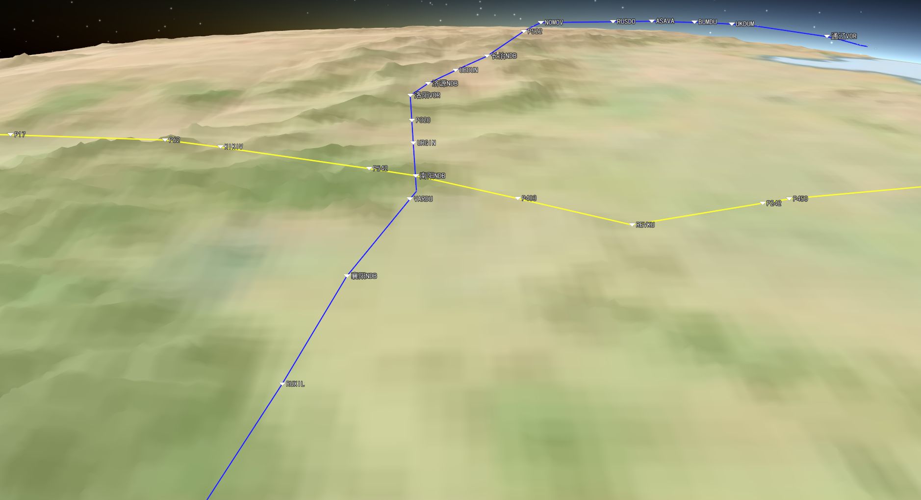
Enroute, company route, flight plan 3D display
NavGlobe provides 3d graphic display of enroute, company route, flight plans etc。
3
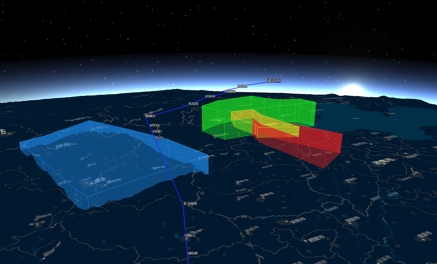
Global airspace 3D display
NavGlobe can display FIR, ATC Control area, Custom airspace etc。
4
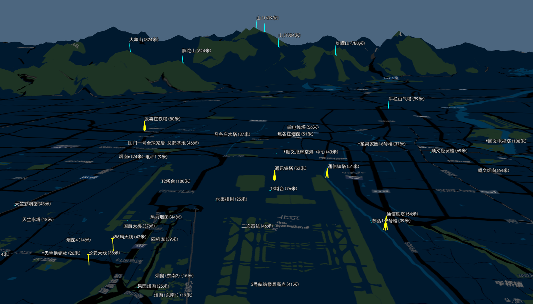
Obstacle graphic display
NavGlobe can display the custom obstacles graphically。
Flight Simulation
1
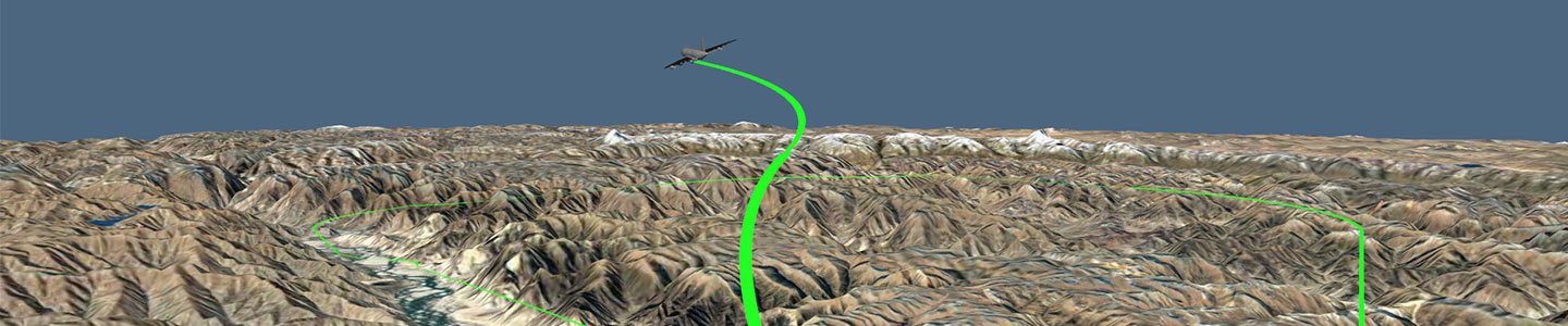
Terminal procedure simulation
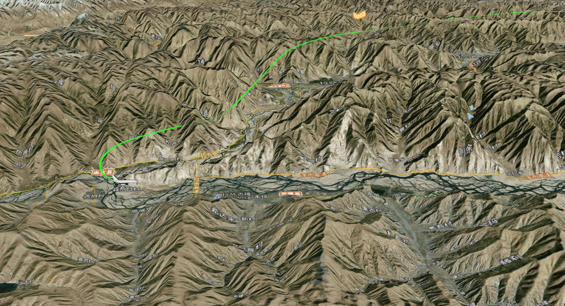
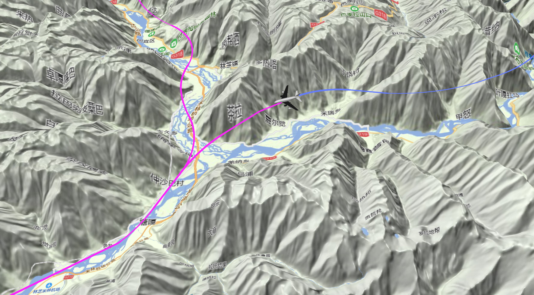
NavGlobe can be used for 3d simulation of global terminal procedures. Flight simulation mode can be selected from pilot's perspective and bystander's perspective。

2
Enroute flight simulation
NavGlobe can simulate enroute, company routes, flight plans, special procedures, etc。
NavGlobe GIS Function
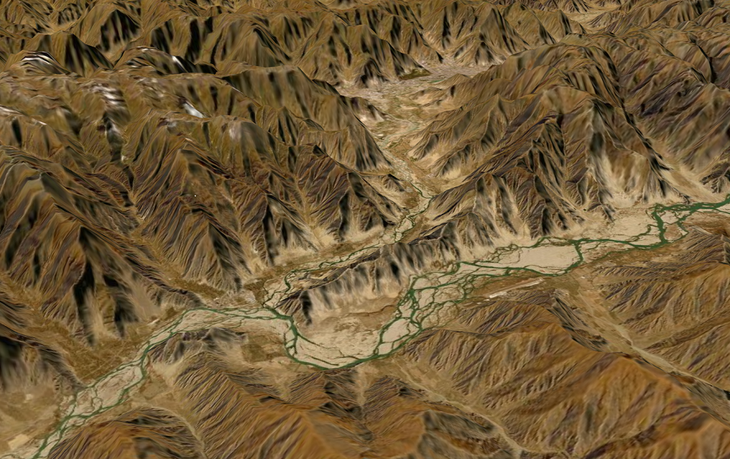
NavGlobe comes with a global 30-meter digital DEM data and supports higher precision digital DEM data。
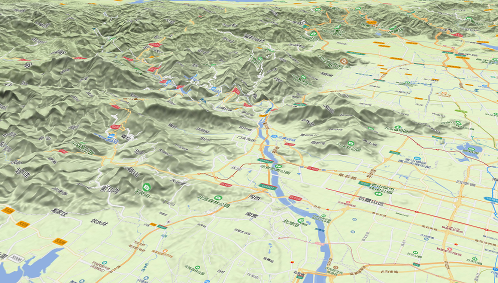
NavGlobe comes with level 0-10 global and level 10-13 Chinese high-definition satellite images and vector map data. It further supports higher-definition map data for specified areas。
NavGlobe supports loading online maps from map service providers in an Internet environment。
4
Spatial computing tool
NavGlobe supports two-point range and azimuth calculation, according azimuth and distance calculate coordinates etc。
NavGlobe Powerful Performance
1
Powerful graphics processing ability
NavGlobe uses an advanced GIS graphics engine and utilizes the high-speed computing power of the graphics card’s GPU for graphics processing. The graphics processing efficiency and operation fluency are comparable to mainstream 3d graphics platforms such as GoogleEarth and ArcEarth etc。
2
Flexibility and conveniency
NavGlobe is compatible with all versions of Windows OS. It supports single Computer, LAN and Internet working environment。
NavGlobe trial version download