NOTAM Visualization System
Product Introduction
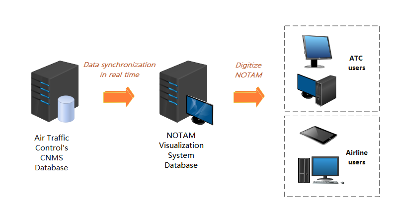
Our NOTAM visualization system is mainly used to provide solution for dynamic process and real-time graphical display for NOTAM of civil aviation airports. The system is developed to improve the efficiency and quality of NOTAM publication for AIS officers of ATMB, enables to have a more standardized text, easier to understand by other users, and facilitates analysis and application in a systematic way.
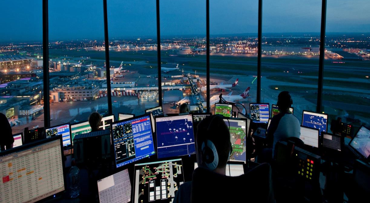
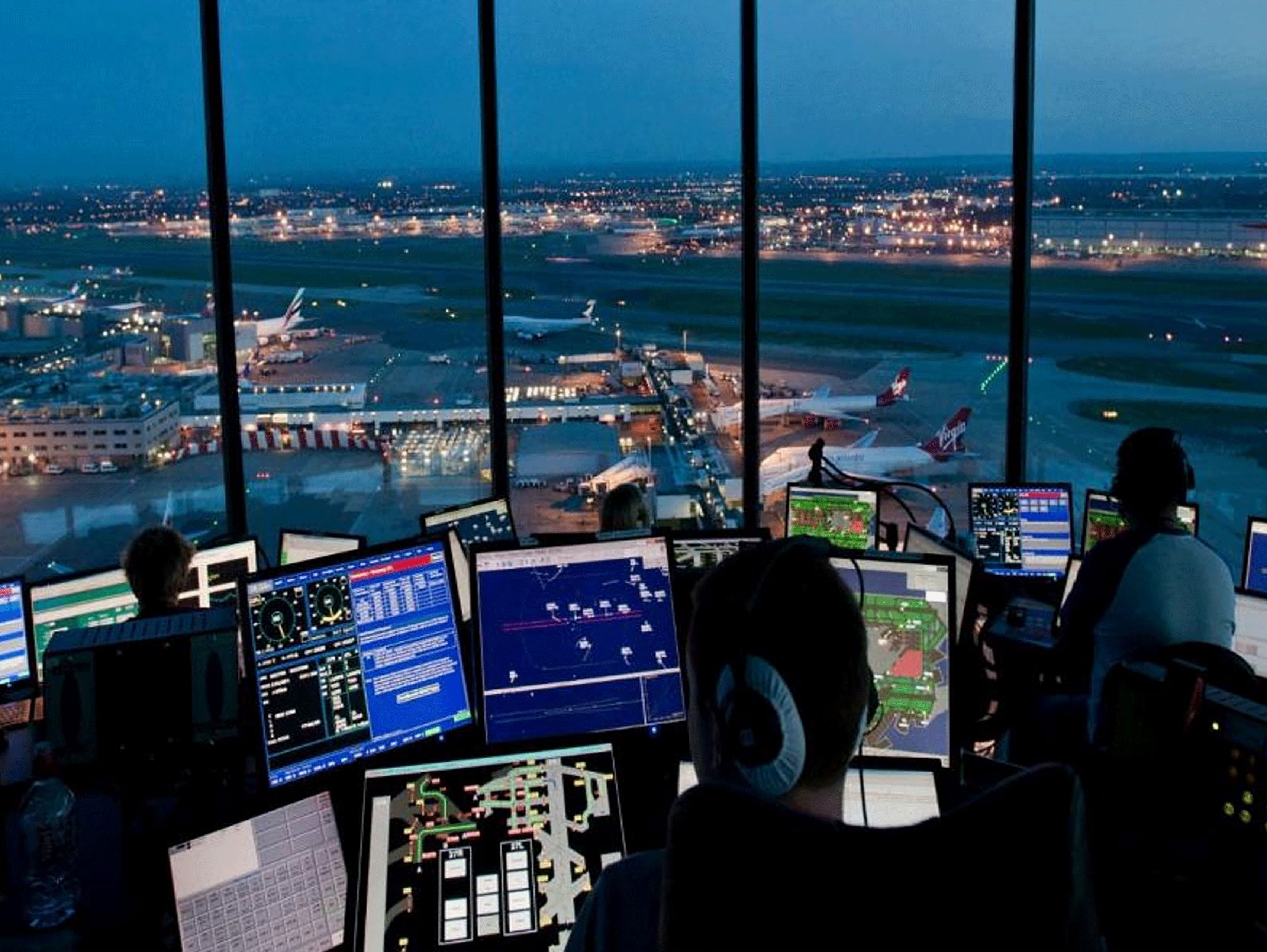
For ATC controllers, this system displays the dynamic graphics of NOTAM in real time on the digital airport map, which is more intuitive and effective than in a texture way, easily understood, operated and handy, improving operational safety effectively.
From perspective of pilots and dispatchers, to capture the availability of airport facilities and equipment in a graphical way, enables to improve situational awareness of operational facilities, and guarantees operational safety.
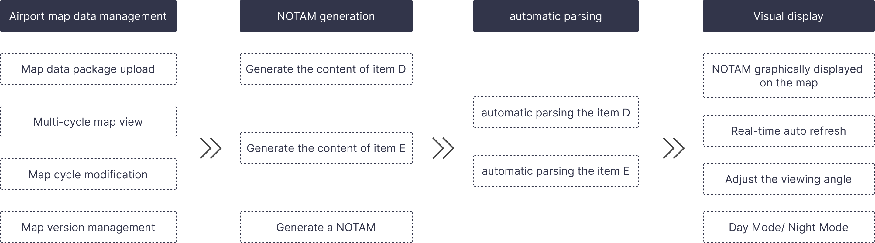
Main Functions
Product Benefits
1
Intelligent Template Processing Technology of D-NOTAM
NOTAM Visualization
Fully Compliant with industry standard
Automated NOTAM Processing
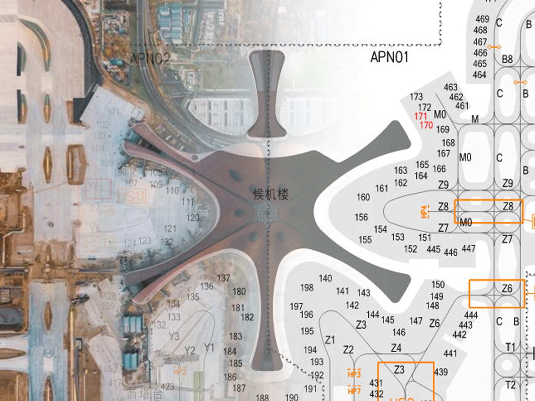
Applied to digital airport maps directly
2
Digital Mapping Technology covering airport surface elements
AIP as a reliable data source
Integrated GIS, the compatibility with AIXM 5.1 is ensured
In compliance with the regulations of AIRAC, the data update every 28 days
3
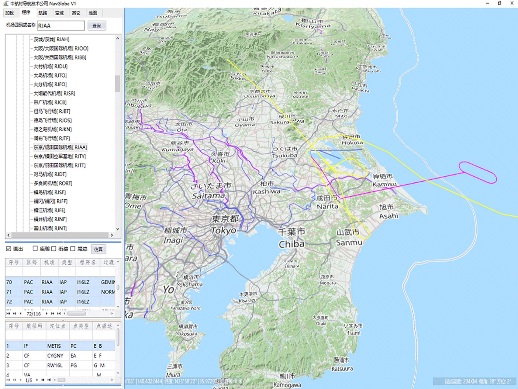
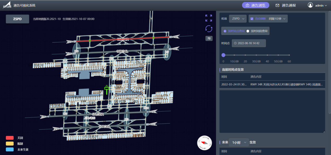
Technologies of Visualize NOTAM
Based on digital airport map
Overlay the status of each element by timetable (available, unavailable, restricted)
Automatic web page Refresh/Display in a real time
The map can be rotated to a specific angle on the actual view of controllers and AIS officers
Day and night display modes
As a service provider of NAIP/AIP Aeronautical Chart Data production for AIS, CAAC, NavChina provides Aeronautical Chart Data Service for domestic and foreign users directly or indirectly. Advanced Technologies and concepts are applied in the fields of production for Digital Aeronautical Chart Data, ARINC424 Navigation Data, Digital Aeronautical Information Processing and Electronic Flight Bags (EFB) .
Applications
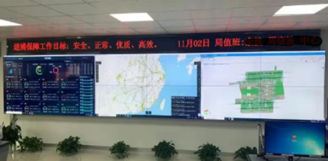
● In cooperation with East China ATMB, NOTAM visualization system is verified in June 2020, thus applied officially into production in Hongqiao, Pudong, Shanghai Airports.
● Awarded the 2nd Prize of 2019 CATA Science and Technology.